Marine multifunction displays have revolutionized boat navigation thanks to their advanced yet easy-to-use systems. These machines combine navigation sonar, radar, weather, communication tools, and more into one convenient system. In 2009, multifunction displays took on a new face, integrated into smartphone apps for iPhones, tablets, and Androids, the first of which is iNavX.
Ever since, more apps have become available with enhanced software, making them a first choice for some and a reliable backup app for others. Why? It comes down to your boating preferences! Multifunction displays are usually installed in a fixed location on your boat, making them less portable than smartphones. However, multifunction displays offer larger screens and better visibility in sunlight. Multifunction displays are often waterproof and have more features but are a more expensive initial investment than smartphone apps with a robust number of features at a lower price.
Some smartphone apps have wireless integration that allows route planning on your smartphone or tablet, which will transfer to your MFD or can be used to synchronize waypoints, routes, and tracks with multifunction displays. Navionics and Garmin Blue Chart Mobile integrate with the Garmin MFD, while Ray Marine’s mobile app works with their MFD!
No matter your preference, we think it’s important to discuss what these smartphone apps offer, as they can be a valuable tool at sea. In this article, we will rank the best boat navigation apps with the most multifunctional features, the best app interfaces, the apps with the freest features, the apps with the best integration possibilities with other instruments, and our overall best pick.
Best Multifunctional Features Apps
Navionics
Navionics is an excellent app due to its many features. It contains up-to-date detailed charts you can use offline wherever you go, including multiple overlays, port plans, anchorages, safety depth contours, navaids, and sonar charts. These charts are 1’/0.5m HD bathymetry map charts with detailed bottom contours that help you find new fishing areas. You can edit chart-overlay combinations to customize chart views, highlight shallow areas, and target multiple fishing ranges.
One of the most significant points is that Navionics includes daily updates worldwide. Not all apps update as frequently! This app contains real-time weather data with daily and hourly forecasts and wind, water, buoys, tides, and current data. It can place markers on anchorage spots or where you reel in a fish to save for next time. Navionics has an active community, including the Active Captain community, with thousands of boaters with information and first-hand experience. You can share and save data outside the app or transfer it to your chart plotter, including sharing marinas, repair shops, or other locations outside the app.
Navionics is compatible with the Garmin chart plotter through the Navionics chart plotter card subscription. U.S. and Canadian lakes, rivers, and coastal marine maps cost $49.99 a year, which is average compared to the other apps listed. The biggest concern with this app is that in 2023, the price increased almost double, with no added features. It also has a somewhat problematic offline mode for users. Navionics official website.

Navionics chart by the water. Navionic photo.
iNavX
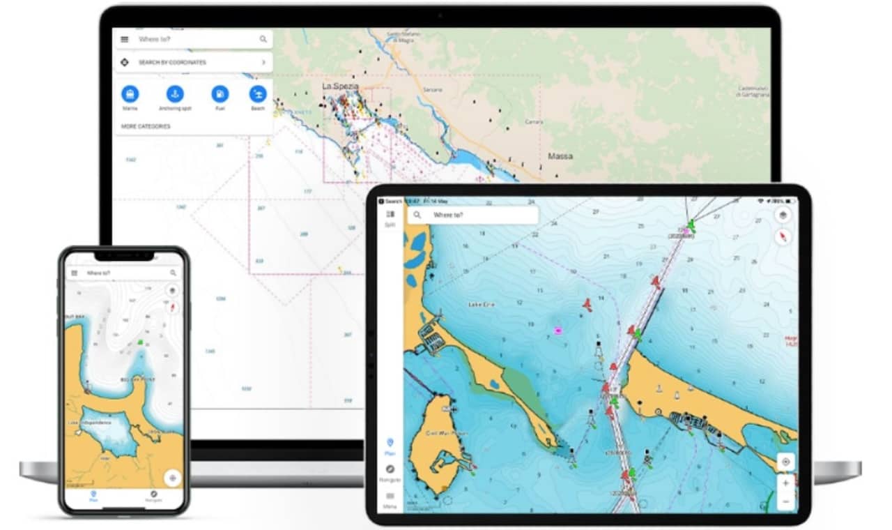
iNavX has many features and claims to be the only smartphone app with worldwide coverage. It gives users access to marine charts and maps, including Theyr Premium, Professional+ Charts, Blue Latitude, CHS, Explorer, and Waterway Guide. It includes sailing routes with waypoints and route management with GRIB weather forecasts. It also includes AIS overlays that will integrate with your onboard systems.
iNavX has up-to-date boating conditions, including currents, winds, and swells. You can manage your boating equipment with nautical instrument integration, which saves boating routes to a shared track log. In the advanced chart plotter, you can plot your real-time position using its GPS, pan zoom, rotate charts, and print detailed charts to use with the app.
Your waypoints can be tracked and imported in KML or GPX format and will integrate with external GPS and AIS receivers, depth, speed, wind, engine, and battery instruments. Lastly, the app comes with anchor alarms and port/invalid search. iNavX has premium subscriptions ranging from $9.99 to $299 a year. The downside to iNavX is that their current raster charts are not quilted, customers state they have an overly complicated instrument feed, an annual subscription is required to update charts, and if you’re viewing Navionics charts, there is no access to the sonar charts in iNavX. iNavX official website.
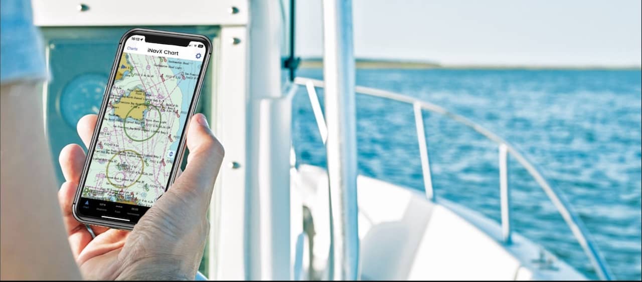
Handheld chart plotter. iNavX photo.
Best App Interfaces (Ease-of-Use)
Aqua Map- Mobile Chartplotter
Not only does Aqua Map have an excellent interface that can be quickly learned, but it also has many categorized features. Aqua Map has the latest charts you can use offline, including weather, tides, and POIs from ActiveCaptain and Waterway Guide. It can connect to your boat's AIS and GPS, making it cross-compatible with your other instruments. You can plan routes, record your tracks, and find friends on the water while sharing your data across the live-sharing community.
More features include vector and raster nautical charts for offline use, regular updates, satellite images, real-time route navigation, information on bridges and hazards, and the best fuel prices! Aqua Map has one of the best anchor alarms and AnchorLink with mirroring and email/telegram notifications with an excellent display.
Aqua Map has marine forecasts for wind, waves, currents, and worldwide weather information. It has 1800+ weather buoys to get real-time sea info, tide and current predictions and simulations, 14000+ vector lake maps, easy sharing and uploading of track markers and routes, real-time depth sounder, wind sensor, compass, and GPS display. Depending on the maps you download, you can buy a yearly subscription ranging from $4.99 to $69.99. The downside to this app is that reviewers state their depth boundaries, which can be confusing. Aqua Map official website.
Real-time sea info on Aqua Map. Aqua Map photo.
Savvy Navvy
The second you open your Savvy Navvy app, you will notice how easy it is to navigate and how modern the interface is! They have highly detailed nautical charts that aren’t cluttered and colored well. They have a premium subscription, including weather forecast graphs to scroll through to see weather conditions, wind strength, and direction, including their unique Course to Steer (CTA) automatic weather routing.
They have free local marina and anchorage information, including the VHF channel, mooring details, restaurants, bathrooms, toilets, fuel docks, and more. Savvy Navvy has only four buttons on the bottom with a small set of options on each page, making the menu easy to understand. Savvy Navvy’s premium price is $99 a year, making it one of our more expensive options. The drawback is that their free version does not give you as many features as some other apps, but if you pay the premium price, you will love it! Savvy Navvy official website.
Various interfaces on Savvy Navvy app. Savvy Navvy photo.
Best App Integration Features
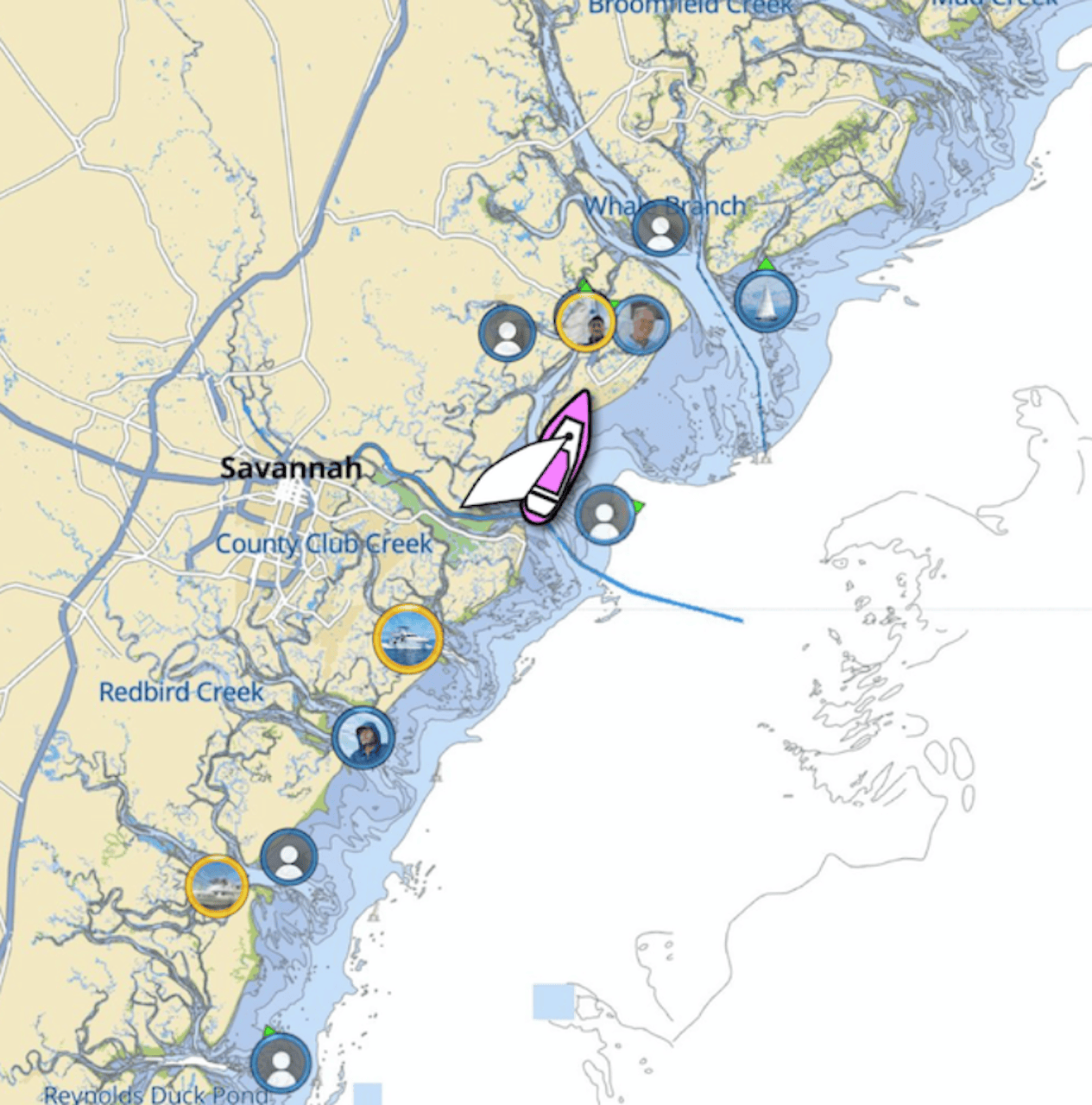
Active Captain
Garmin’s second app, Active Captain, connects your mobile device with their chart plotters! This app will plot charts, show charts and maps on your smartphone, and contact you with the boating community. You pair the app with your compatible chart plotter to transfer wirelessly and access charts and maps, software updates, routes, and waypoints. This was rated the best integration because this app is excellent but intended only for use with the Garmin chart plotter and is not recommended for stand-alone use.
Active Captain uses Garmin Navionics cartography featuring the same style, appearance, and advanced technology with a one-year subscription to daily updates. This app has exceptional coverage, clarity, and detail, plus the NOAA raster cartography (3) premium features.
The best part about this app is that you can monitor and control your switches, such as the top of your bilge or your doors, to turn them on or off through the app. Conversely, your chart plotter can receive calls, text messages, and more, so you can put your phone away where it is safe and dry! Active Captain is free to use and connect to your devices and community. The biggest issue with this app is its lack of compatibility with non-Garmin instruments and its relatively poor ability to be a stand-alone app for those who don’t have a Garmin chart plotter. Active Captain official website.
Alerts and pins on the water. Active Captain photo.
C-Map: Boating
C-Map is compatible with the Simrad NSX series, the B&G Zeus S series, and many other instruments, making them a top integration choice. Some of its best features include full planning and navigation, Auto Routing™ tracks, waypoints, and thousands of points of interest. It has a free chart viewer with access to the most up-to-date C-MAP charts. It has unlimited offline map downloads, GPS, and full navigation mode. You can import and export your GPX files to share your routes, tracks, and waypoints with friends!
It also includes a marine weather forecast, weather along the route, weather overlay, chart personalization, high-resolution bathymetry, custom depth shading, a measure distance tool, and shaded relief. This app is constantly updated with the most up-to-date maps and new features and functionalities.
The C-Map map browser and planning tools are free, and the premium subscription is only $14.00/year, which allows unlimited offline map downloads, viewing of your GPS position, and access to the full navigational features. However, lake boaters beware. Reviewers note that some local lakes are unavailable or have limited range despite C-Map stating that all are provided. C-Map official website.
C-Map charts on iPhone, iPad and desktop. C-Map photo.
Best Free Navigation App
Argo
This is one of our favorite free boat navigation apps because it's high-quality and the only app that is free to download and completely free to use! You can find routes to new destinations anywhere in the United States, track your boat trips, see your friends on the water, and get information from other boaters through their online community.
Argo uses NOAA/USACE charts that auto and manually route to thousands of water destinations. You can save all your boat trips on your smartphone and see 7-day weather conditions, wind, and tide forecasts. Despite most of these apps locking away features behind premium, you can see offline charts, custom depth shading, captain's log reports, and import and export GPX files on ARGO for free. It truly is an excellent app, considering the price. The cons to this app are that it has limited features compared to Navionics and other paid subscription features and isn’t updated as frequently. Argo official website.
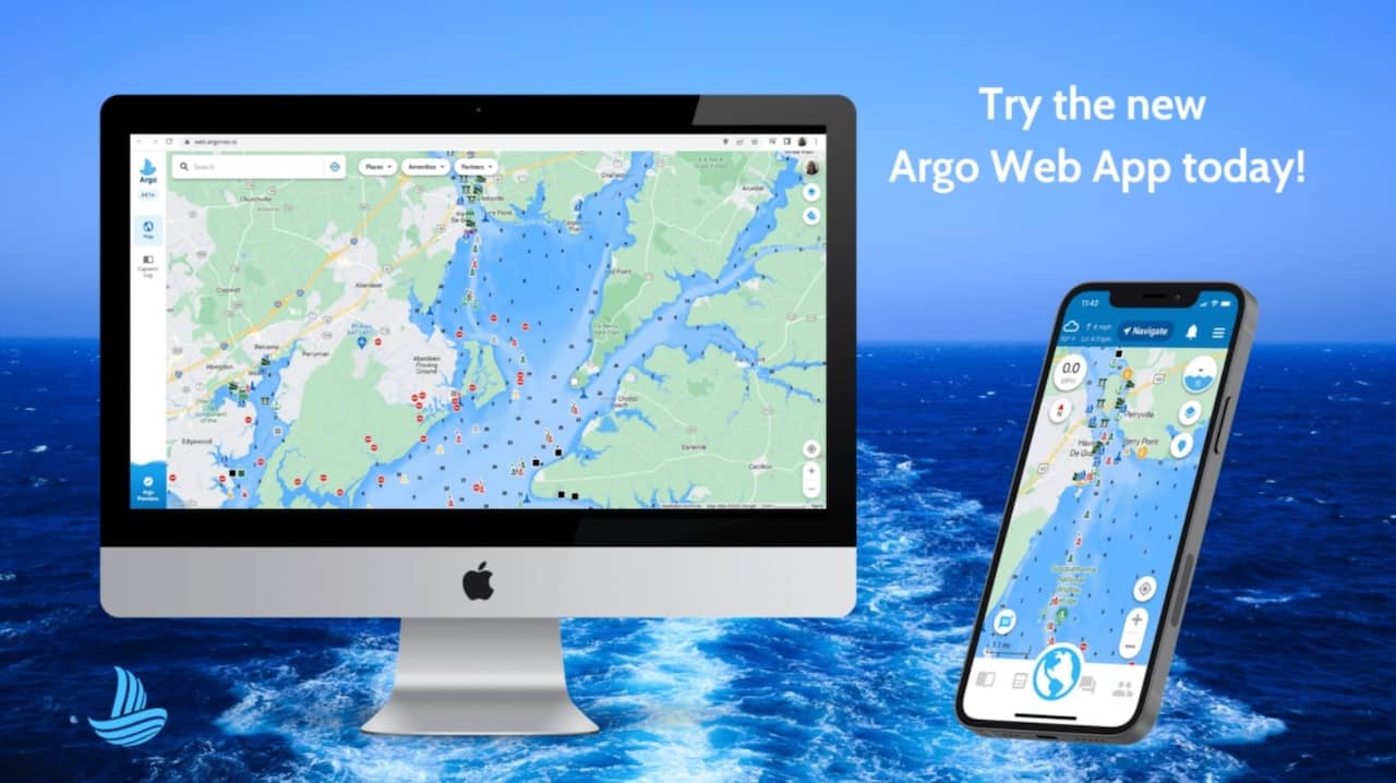
New Argo web app unveiled. Argo photo.
Best Overall Marine Navigation App
Navionics
Though you can’t go wrong with any of the apps, Navionics checks all the boxes regarding features, interface, integration with other devices, and price, making it our overall top choice. It is a great stand-alone app and pairs wonderfully with Garmin's other instruments, making it a trustworthy and dependable option no matter the adventure. We hope one of these apps will improve your planning and navigating the next time you’re on the water!
Related Articles and Guides
19th Jul 2024
The World’s Best Yacht Brands
12th Jul 2024
Top Performance-Boat Brands, Where There’s Something For Everyone
28th Jun 2024
Best Center Console Boats: The Best Brands Across the Spectrum
23rd Jun 2024


